Thunderstorm24
Lightning observations and forecasting
Thunderstorm24
home
Historical
data
Daily maps Europe (2005-2019)
Lightning
observations
Lightning from the start of the day
Cloud tops and lightning over Europe now
Lightning from the previous day
Lightning
forecasts
For the next three days
Weather
forecasts
Sea level pressure and 3h precipitation
10 m wind
700 hPa Relative Humidity and Horizontal Wind
Total Precipitable Water
Storm Relative Helicity (0-3 Km)
MUCAPE, MUCIN & 0-6km Bulk Wind Shear
Updraft Helicity
Potential Vorticity at 300 hPa
Lifted Condensation Level & Bulk Wind Shear
Storm Motion
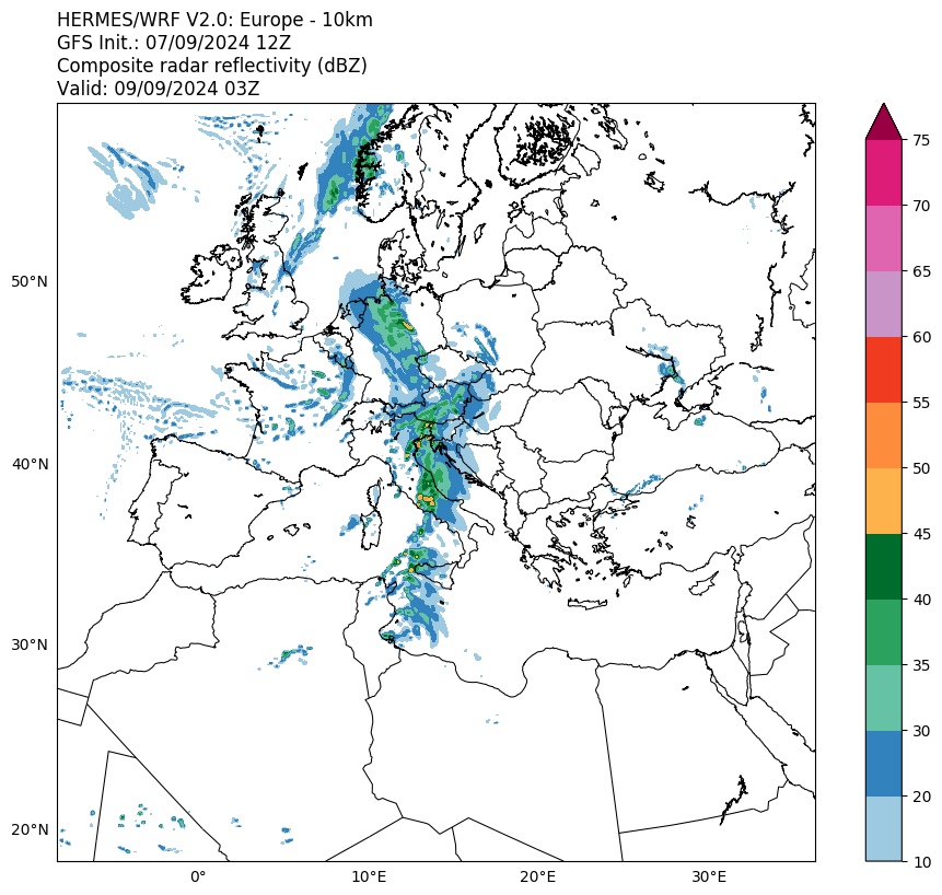
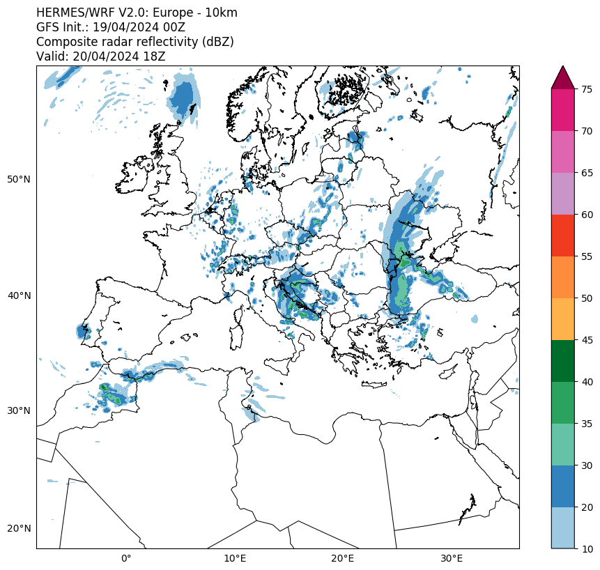
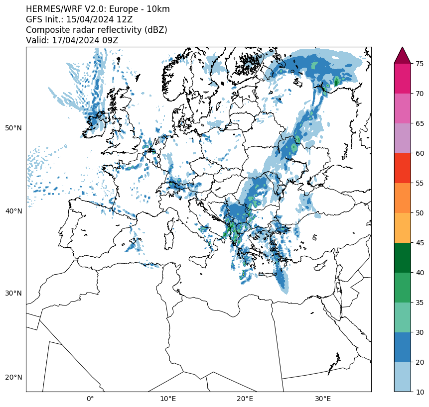
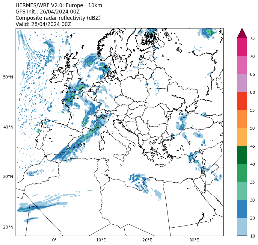
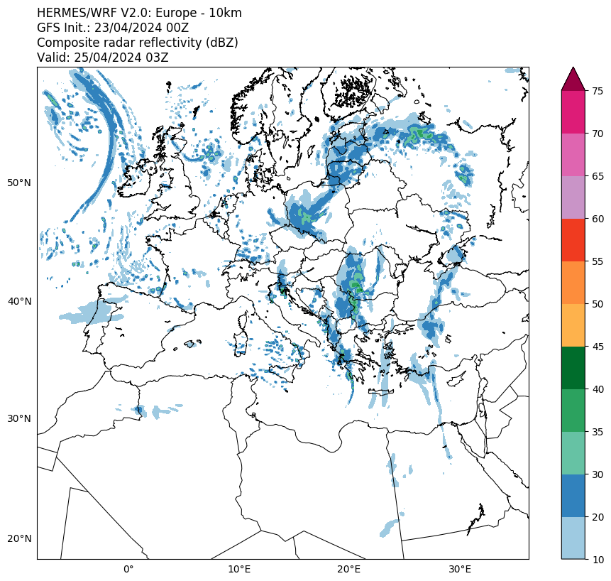
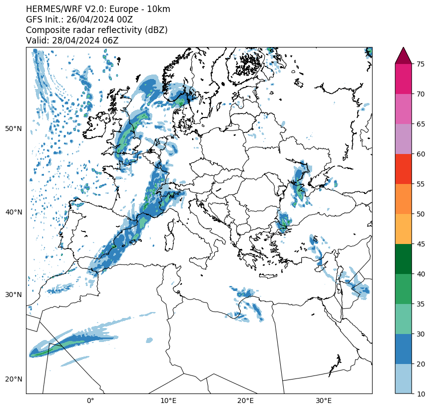
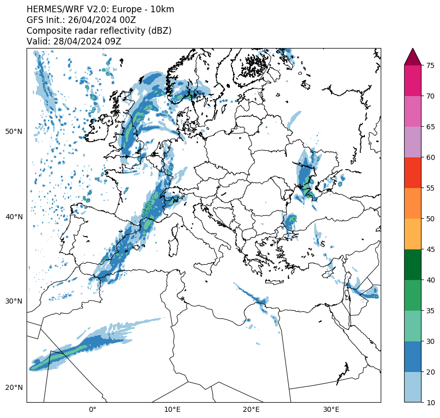
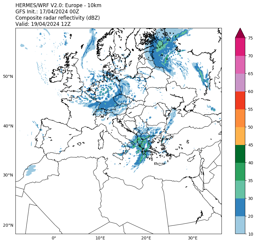
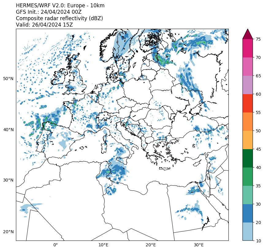
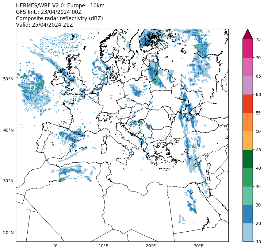
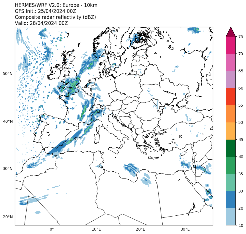
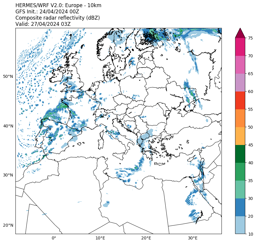
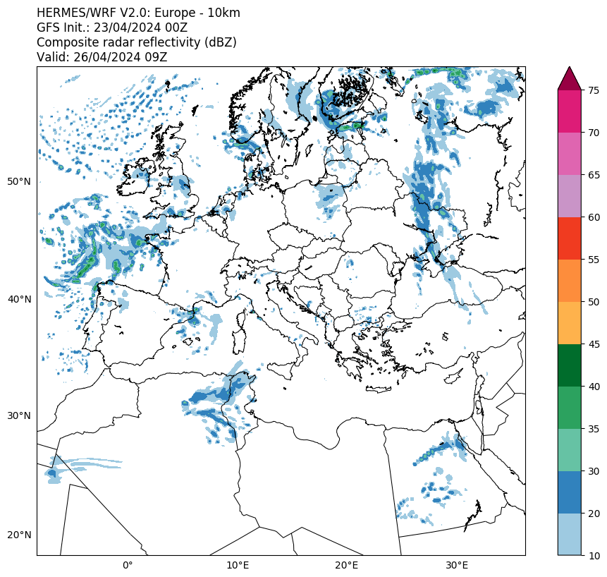
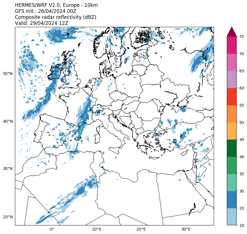
Composite Radar Reflectivity
Cloud Top Temperature
Satellite
products
Convective Rainfall Rate
Cloud Top Height
Total Precipitation Probability Level
Tropopause Penetrating Clouds
Lightning
gallery
General
information
Safety
Lightning
Thunderstorm
What is the Zeus system?
Interesting links
Contact
us
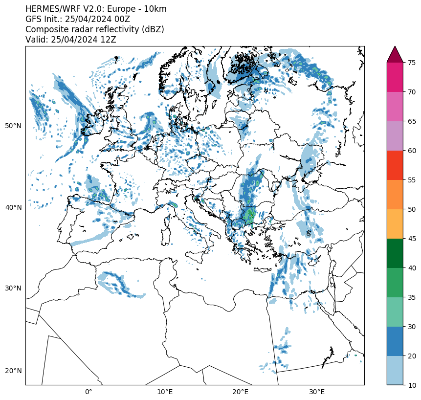
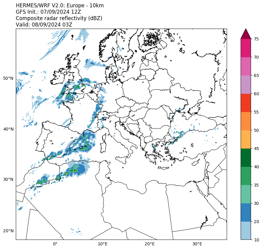
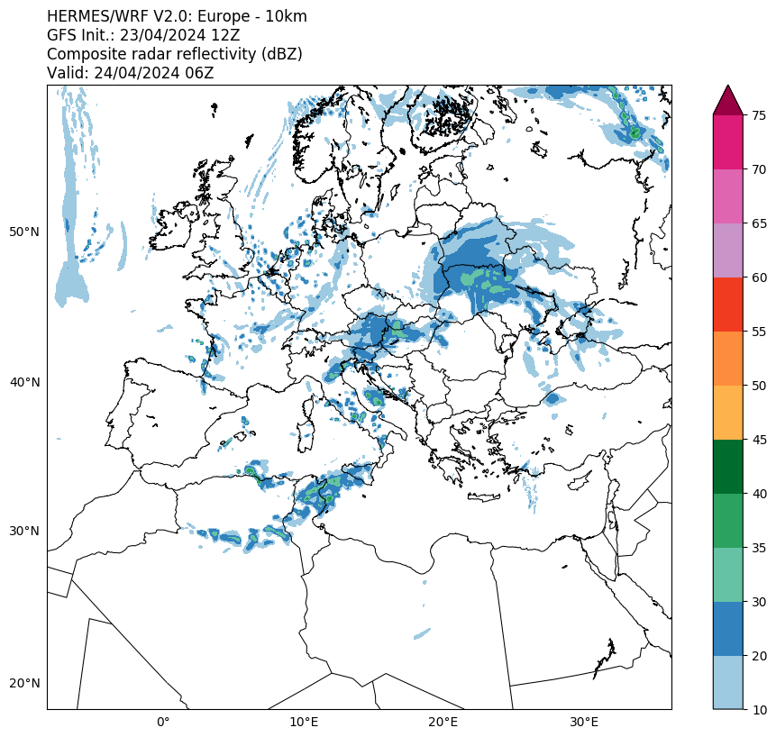
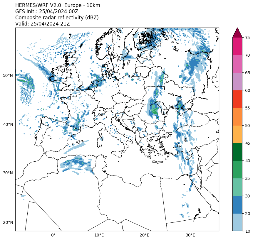
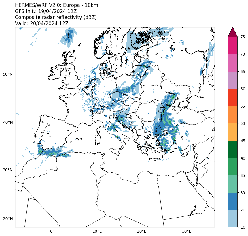
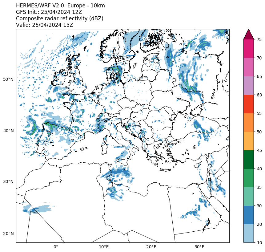
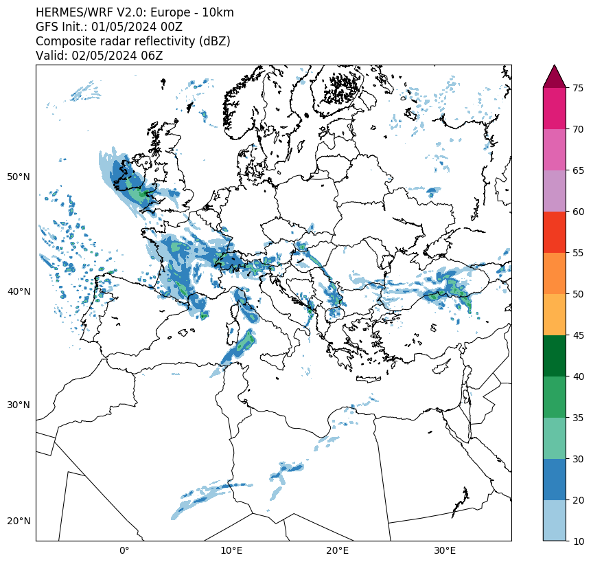
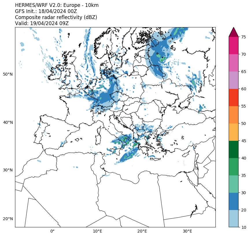
WRF Model - Composite Radar Reflectivity
Sat 16 May 12:00
Sat 16 May 15:00
Sat 16 May 18:00
Sat 16 May 21:00
Sun 17 May 00:00
Sun 17 May 03:00
Sun 17 May 06:00
Sun 17 May 09:00
Sun 17 May 12:00
Sun 17 May 15:00
Sun 17 May 18:00
Sun 17 May 21:00
Mon 18 May 00:00
Mon 18 May 03:00
Mon 18 May 06:00
Mon 18 May 09:00
Mon 18 May 12:00
Mon 18 May 15:00
Mon 18 May 18:00
Mon 18 May 21:00
Tue 19 May 00:00
Tue 19 May 03:00
Tue 19 May 06:00
Tue 19 May 09:00
Tue 19 May 12:00